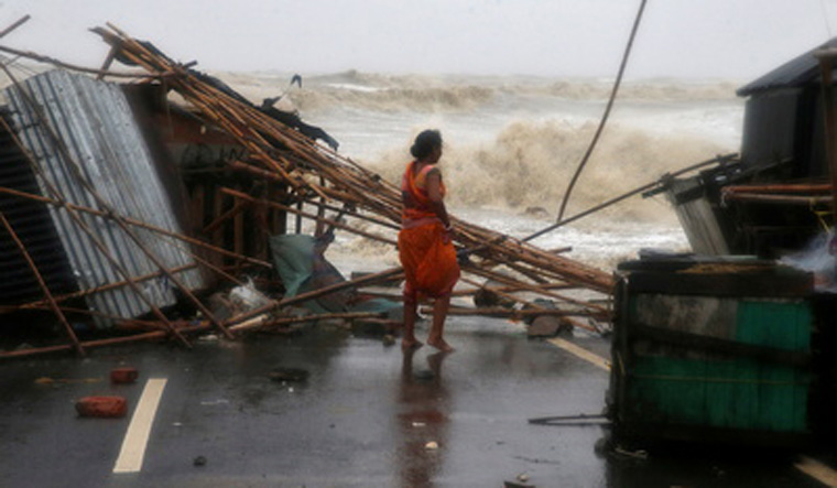
The landfall process of very severe cyclonic storm Yaas began at 9am on Wednesday near the Dhamra port in Odisha's Bhadrak district, an official said. The location of the landfall is north of Dhamra and south of Bahanaga, close to Bahanaga block, on the coast, around 50km of Balasore, he said.
The wind speed during landfall was at 130-140 kmph, gusting to 155 kmph, as per Doppler radar data. "The landfall process has begun and will take three-four hours to complete. The maximum impact will be in Balasore and Bhadrak districts," Odisha's Special Relief Commissioner P.K. Jena said. Around 5.80 lakh people have been shifted to safe shelters, he said.
The India Meteorological Department (IMD) earlier predicted that the wind speed during the landfall would be around 155-165 kmph, gusting to 185 kmph. The landfall process was delayed for some hours with the system's velocity decreasing to 12 kmph from 15-16 kmph, Jena said. The cyclone did not intensify any further after 2am, he said. "Since there has been a fall in intensification, the wind speed was around 130-140 kmph at the time of landfall instead of 165 kmph," he said.
There was no report of any major damage though some incidents of trees getting uprooted have taken place, he added. In West Bengal, the coastal areas in East Midnapore and South 24 Parganas were inundated owing to storm surge, officials in Kolkata said. Several embankments, including 51 in East Midnapore, have been breached as the water level in the rivers in the coastal areas rose, they said.
The maximum wind speed in the coastal resort town of Digha in East Midnapore reached around 90 km per hour. It was 68 kmph at Fraserganj in South 24 Parganas, and in Kolkata, the highest wind speed was recorded at 62 kmph. Several low-lying areas in South 24 Parganas and East Midnapore were inundated owing to high tidal waves. The areas in south Bengal also received a good amount of rainfall since Tuesday night.
The Met department also warned of tidal waves of two-four metres height above astronomical tide to inundate low-lying coastal areas of East Midnapore, and of two metres above astronomical tide in low-lying areas of South 24 Parganas. Most parts of Odisha also received rains, said Umashankar Dash, a scientist at the Regional Meteorological Centre in Bhubaneswar. Chandbali in Bhadrak district received 273 mm rainfall, the highest amount of rainfall in the last 24 hours in the state, followed by Paradip (197 mm), Balasore (51 mm) Bhubaneswar (49 mm).
The IMD has forecast massive storm surge for some places like Mohanpur in Bhadrak where the seawater may ingress 9km into the land. Dash said that surge of 1.5 metre to 3.8 metre is likely in the area when the wind speed hits a peak during landfall. The reason behind such a high storm surge is also partially due to full-moon activity.


